Sunday 28 October 2012

Extwistle Moor and Boulsworth Hill 21.10.12

A circular walk - 13.5 miles.

Boulsworth Hill is listed as the highest point in the South Pennines of south-eastern Lancashire. I have seen its mass on many walks in the area, and decided to draw up a circular route that would incorporate it. Also not to far away was two Trig Points that I wanted to bag if possible, one at Shelfield Farm, and the other at Extwistle Moor. And not forgetting the Trig on the summit of Boulsworth Hill too.

 The forecast was fantastic for late October, sunshine and warm, so the views were set to be good. This time it was a train to Accrington, then changing there for Colne, arriving at 11:15. There was some heavy fog hanging over Calderdale, particularly over Hebden Bridge and Todmorden during the journey, but by the time I arrived into Accrington, and eventually Colne the weather was great with blinding sunshine. Here heading from the station through the back streets of Colne along this steep lane...
This walk involves, to start off with, quite a bit of road walking. But this was necessary in order to bag the Trig Point at Shelfield Farm...
The lane 'Back Lane' wasn't to busy so was a nice walk. Here a distant Boulsworth Hill comes into view...
Branching right from the road here up this very muddy field track towards the high point of Shelfield Farm...
And to the Trig Point at 338 metres, with the unexpected find of Walton's Monument next to it. Also some great views towards Pendle Hill from here...
And the Trig Point in relation to Boulsworth Hill...
Walton's Monument...
Back onto Back Lane now, heading towards Coldwell Reservoir...
Turning right here onto Halifax Road with another unexpected find, this Pillbox. Someone was prepared for the Nazi's invading...
Here heading off Halifax Road and down this steep embankment towards High Ridehalgh Farm...
A warm welcome at the farm...
The path got a bit confusing here crossing the farm's pastures, but I continued on downhill towards Thursden Brook...
A conveniently placed footbridge to get you across the brook...
On the other side of the brook a muddy pathway climbs steeply here up towards the Bronte Way...
After crossing over the Bronte Way, the official path disappears and your then following a lane up onto the edges of Extwistle Moor. On the day I went, the edge of the moor was being used as a makeshift motocross track with bikes whizzing around it, and I had to move quickly to get out the way at one point. There was a well built notice warning people of this so I had no excuses, also on Saturday's according to the sign this part of the moor is used for clay pigeon shooting urging you to stick to the footpaths!
 After getting past the noise of the makeshift motocross track it was good to get out onto the open moor, here Boulsworth Hill doing a good impression of Cross Fell...
And to the Trig Point on Extwistle Moor at 380 metres, and also time to refuel...
Heading across the very boggy moor now following this wall...
It was a tough bit of walking across the moor, and the bogs were at their worst here. But eventually I made it onto this pathway. I headed straight ahead here across the moor...
 It's a boggy pathway, but a well walked pathway so easy to follow. It brings you out onto Ridehalgh Lane...
 Straight across Ridehalgh Lane I followed this track cutting across the edges of Widdop Moor...
The track brings you out onto this great bit of moorland. On the left is Boulsworth Hill, on the right is Dove Stones...
The track comes to abrupt end after a good mile. But a well walked path is visible across the moor to the side of Boulsworth Hill...
A gradual climb up the southern side of the hill brings you out onto the wind swept plateau of Boulsworth Hill...
Heading towards the summit here...
Boulsworth Hill summit Trig Point at 517 metres (1,696 ft)...
The summit is known as Lad Law and commands some fine views north west towards the Forest of Bowland, with Pendle Hill being the most prominent hill visible. Also clearly visible is the town of Colne, and Weets Hill above it, all visible in the below photo. To the north is the outline of Ingleborough, the very top of Pen-y-ghent and Great Whernside. Pinhaw Beacon is another high point visible. To the north east Ilkley Moor, and Simon's Seat are also just about visible...
Heading north east now from Lad Law across the truly awful bogs of Boulsworth Hill...
There is a well walked path that allows you to descend the hill across Pot Brinks Moor, about half mile north east from the summit...
Colne and Weets Hill from Pot Brinks Moor...
Heading towards Boulsworth Dyke...
The Bronte Way skirts the base of the hill. I cut across it and headed across this sheep pasture towards Gilford Clough...
Into the trees of Gilford Clough...
There are lots of ways you can get back to Colne, and I seemed to take the muddiest. But the views were always good...
And finally back into Colne railway station, the terminus of the East Lancashire Line, for my train home...
This was a great walk to finally bag Boulsworth Hill with some of the finest scenery in The Pennines. Thanks for reading.

Thursday 25 October 2012

SealSkinz Winter Gloves Review

5 out of 5 stars.

This time last year I was in need of some new winter gloves. I had worn gloves in the past that were good in cold wind for a time, but before you know it the ends of my fingers were getting numb. I was also looking for some that were waterproof preferably, you can almost guarantee a bit of moisture somewhere on a winter hike, whether it be a wet rock face, or the heavens opening to give you a good soaking.
 I had looked at many pairs of gloves, some at ridiculous prices that were said to be waterproof and windproof. But one manufacturer seemed to stand out for me, and that was SealSkinz. They have a really good reputation, and produce many different models of quality gloves for very reasonable prices. The model that seemed to tick all the boxes for me was the Winter Gloves retailing at £30, straight to the point they are warm and waterproof, and believe me they really are, they have had a real soaking on the majority of winter hikes and they didn't wet out once.
 They are windproof too, and very snug. If anything your hands can become to warm in them when on an ascent of an icy peak somewhere, but they are a real comfort to know they are in your rucksack ready to be put on in freezing conditions. On winter hikes I wouldn't leave home without them.

 The SealSkinz Winter Gloves:
~Waterproof
~Windproof
~Comfy lining
~Extremely breathable
~Velcro cuff fastener
~Grippy palm area

Overall a great pair of gloves that won't let you down, that I couldn't recommend more.

Saturday 13 October 2012

Lodge Hill, The Lawley and Caer Caradoc - Shropshire 4.10.12

A circular walk - 13.5 miles.

I was back in Shropshire for a week, I had done one walk already across the rugged side of the Shropshire Hills - The Stiperstones. I wanted to do another walk in the Shropshire Hills before I left, but this time I wanted to return to the truly stunning hills that surround Church Stretton. This part of the county was regular walking country for me when I lived in the area, and one hill that I had in mind in particular to visit again was Caer Caradoc, probably the most distinctive hill as you approach Church Stretton from Shrewsbury.
 Lying next to Caer Caradoc is another stunning hill called The Lawley, which I had never been up before. So I drew up a circular route that would incorporate both of them - also bagging the Trig Point on neighbouring Lodge Hill.

 It's a 15 minute train journey from Shrewsbury to Church Stretton, and I arrived into the pretty little town at 10 am. The weather was certainly looking good, with Caer Caradoc and The Lawley looking good from the train in the morning sunshine.
 Both hills lay on the not so popular side in terms of tourism of Church Stretton, the vast majority of people visiting the town usually head for the truly stunning Carding Mill Valley. However the eastern side of the town is pretty quiet on the tourist and even hikers front, despite the equally as stunning scenery.

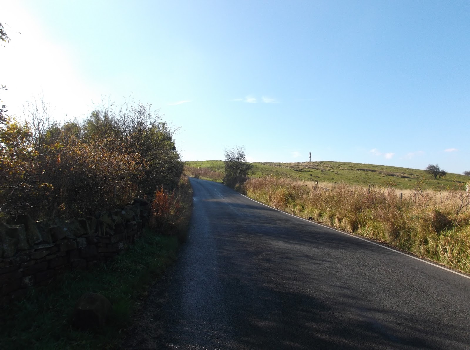
I walked out of the station and headed east towards the incredibly busy A49 road. Risking my life, I crossed thankfully without incident to follow the road north for 300 yards before turning right up the B4371. I followed this road for a good mile before turning left up this track...
The last time I walked along this lane was just over a year ago after scaling near by Hazler Hill and then taking on Hope Bowdler Hill. This time ignoring the inviting path cutting right from this track towards Hope Bowdler Hill, I continued along the lane...
 A gap in the hedgerow reveals Caer Caradoc looking stunning on this morning...
 Taking the track right here by-passing Cwms Farm...
 Onto the flanks of Hope Bowdler Hill here, this path follows the base of this hill for about half a mile, and then neighbouring Willstone Hill...
 Heading right here on another lane/track...
 Looking back at Willstone Hill...
 Taking a path left from the lane/track bringing me out onto this  view. Little Caradoc is the hill on the left, and The Lawley is on the right...
The route now continues along a footpath over an area on the map called 'The Wilderness'. This eventually brings you out onto a lane...
 The lane continues towards a crossroads at Broadstone, before a climb towards the tiny village of Enchmarsh. Once in the village, I cut left along this muddy track...
 This lane climbs then cuts right along Hoar Edge before entering out onto another country lane...
 Been a while since this was last on the tracks no doubt...
 Into the trees of Birch Coppice now, on the edge of Lodge Hill...
 After loosing the path in the thick bramble and bracken filled undergrowth, I followed this dry stone wall to the summit. Probably not the best idea...
 The summit of Lodge Hill at 304 metres, looking towards The Wrekin on the horizon...
 Some good views from the recently deforested summit...
 Following a muddy path now, back towards Birch Coppice and the country lane...
I followed the lane for about a mile to the base of The Lawley. There is a car park where the ridge begins, but I found a small path that cut up the side of the ridge and onto the main track to the hill...
 The trees soon disappear as you climb higher...
 Easily one of the most beautiful hills that I've climbed...
 And an unusual summit marker, great though! You can make out in this picture the old Trig Point base too...
 There was some great views from the top of The Lawley on this day towards the hills surrounding Llangollen to the north west, the Berwyn Range, the Arans, and into the rest of Snowdonia. Looking north east you could make out the buildings of Wolverhampton, back towards Buildwas Power Station, The Wrekin, into Shrewsbury, and the very southern tip of the Pennines in the far north. To the south you could see towards Radnor Forest, Black Mountain, and towards the distant Brecon Beacons. A truly stunning panorama from the summit of this beautiful hill...
 And south towards the next climb, Caer Caradoc...
 It's a steep descent from The Lawley, which brings you out onto a lane. Following the lane left, I followed it towards the village of Comley, then took this foot path left which follows the western edge of Little Caradoc...
 Then after following the wooded path for about half a mile, I cut left and followed this path steeply uphill cutting between Little Caradoc and Caer Caradoc...
 Cutting right onto the sheep filled lower slopes of Caer Caradoc...
 A classic shot of the Shropshire Hills...
 A fairly tough hike up the side of the hill...
 And eventually to the very windy summit of Caer Caradoc at 459 metres...
Looking south east towards the Clee Hills...
Church Stretton...
Three Fingers Rock on the right, with Hazler Hill centre, and wooded Helmeth Hill on the left...
Hope Bowdler Hill from Three Fingers Rock...
Three Fingers Rock on the descent of Caer Caradoc...
The southern end of the Caer Caradoc reveals the craggy nature of the hill...
A steep little descent...
Heading past New House Farm now looking back at Caer Caradoc...
And finally back to Church Stretton station for the train back to Shrewsbury...
This is a lovely walk around some of the finest Shropshire Hills. Caer Caradoc and The Lawley are two of the most beautiful hills in the country, and a must visit when in Shropshire!
 Thanks for reading.