Sunday 16 November 2014

A rough day on Helvellyn

I had planned to do few days walking in the Lake District. After the birth of my daughter recently I haven't had as much time, or the finances to wander the hills, so this was set to be a good few days. I had booked a guest house in Keswick to stay for 2 nights, my plan was to get to Penrith as early as possible on Thursday morning, then catch a bus to Patterdale to walk Helvellyn in a circular walk, then return to Penrith after walking the fell, to get another bus to Keswick to stay over, - a relatively complicated journey I know, but this is what you have to do if you don't have the luxury of a car! The Friday I had planned to do a long walk over Catbells and on towards Buttermere, and then after another night in Keswick, a taxi back to Patterdale to do a circular walk of High Street before heading back to Penrith to get a train back to Leeds. Unfortunately the weather had other plans for me, now don't get me wrong, I do check the weather forecast - even checking the UK mountain forecast prior to any large mountain walks, however this time the forecast was mixed, the main forecast for Keswick was rain and wind, but, and I emphasise but, the mountain forecast was 'a mixture of bright spells with scattered showers' so this didn't sound so bad, almost a 'come on' really! Plus the rain and wind predicted was not set to hit that area of the country until late afternoon.
 So, I was stood at Penrith station at 9am, where after witnessing heavy cloud over the Lake District fells from Shap summit and flecks of rain on the train windows - this was not looking promising. The bus arrived spot on time and got under way to Patterdale, a place I have never visited before. It is a journey of about an hour from Penrith to Patterdale along country lanes. During the journey the weather seemed to simply be getting worse, Ullswater was looking 'choppy' to say the least, but on a plus note you could still see the fell tops, which is usually a good sign.
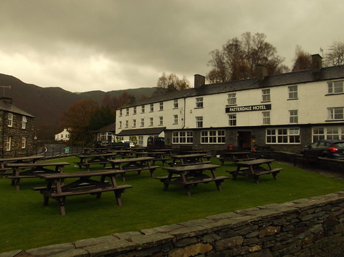
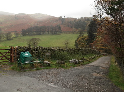
On finally arriving into Patterdale it was light rain, I made my way to the Patterdale Hotel where I had decided to start my walk from, I purchased some refreshment, then made my way towards the foot of Helvellyn.
Here outside of the hotel just after arrival...
Helvellyn 001
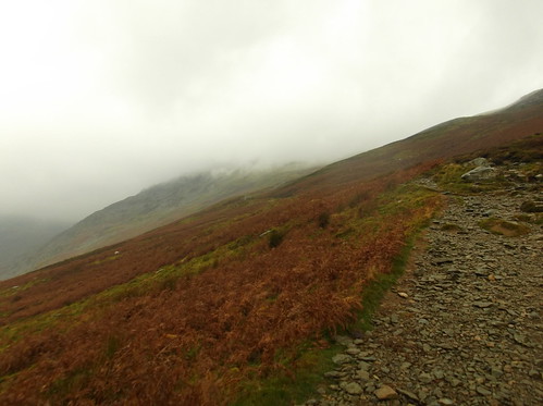
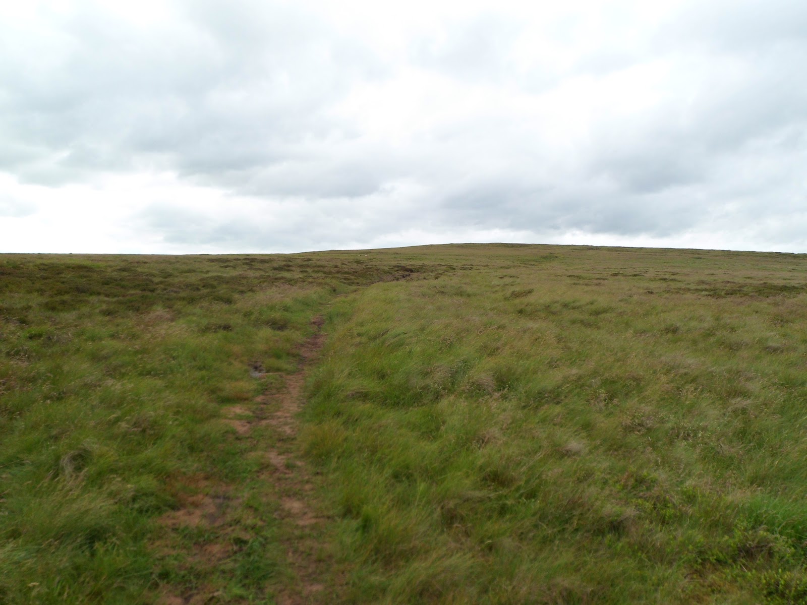
The rain had started to spatter onto my jacket, but nothing in the way of severe weather. My route took me along Grisedale but then cuts up onto the edge of Patterdale Common to navigate the heavily eroded footpath up the side of Helvellyn towards Striding Edge. On putting boot onto the rugged footpath the rain had really started to come down, and the wind was starting to howl along Grisedale.
Helvellyn 006
The fells of Nethermost Pike and Helvellyn itself were swamped in what I would describe as claggy cloud that the wind and rain was rushing out from. After reaching the height of 500 metres I would describe the experience as being hosed down with a pressure washer in a wind tunnel, and the wind was starting to blast me about trying to unbalance me. I was wearing a large pack on my back with my clothes, phone, and wallet in, stuff for the next couple of days, so I had become concerned about how much water was starting to get into my pack. I don't mind admitting that I was starting to get annoyed with this walk now, and the fact the weather was as bad as it was by this point in the day, considering it wasn't predicted for another few hours yet! So I battled onwards and upwards against the elements to a point on the path called Grisedale Brow, and to what is known as the 'hole in the wall' situated at around 720 metres up, this is where a stile allows you out towards Striding Edge. Just before I reached the stile the mountain was acting as a giant wind break, on looking over the dry stone wall that the stile was built into I was knocked back by the shear force of the wind, easily gusts of 60 - 70 mph. Now at one time I might have continued on despite the elements, however this was dangerous, simple as, and would have been madness to continue across a notorious narrow, high ridge in these conditions, and even if I somehow made the ridge, the summit of Helvellyn is a particularly exposed fell that on this day could quite easily had gusts of of 90 mph. So on that note it was time to descend back down the mountain. It takes a lot for me to make a decision like that on a peak, but this seemed the only option. It was also on this decision that with the weather set to be worse for the following two days, to simply go back home!
I know this isn't exactly 'Touching the Void' stuff, but this was my version 'A Rough Day on Helvellyn' :)
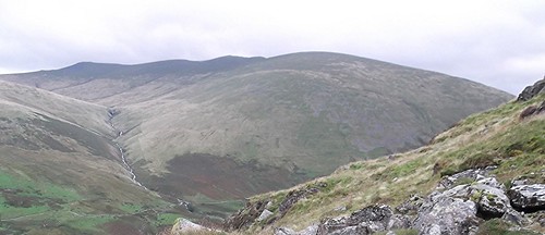
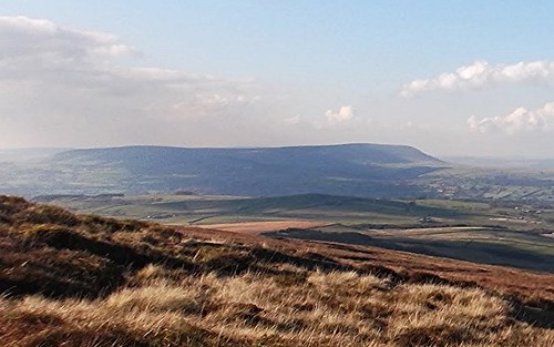
I leave you with this final photo I took just beneath Grisedale Brow. Thank you for reading.
Helvellyn 011

Simon's Seat

 photo SimonsSeatwalk004_zpsa30a0302.jpg
Location: Yorkshire Dales - North Yorkshire
Height: 485 metres (1,591 ft)
Summit Type: Rocky/Boulder Strewn
Notable Summit Objects: Trig Point
Description:
Simon's Seat is a rocky, wild moor top that makes for a great walk from many different locations in the Yorkshire Dales. Its close proximity to places such as Bolton Abbey, Barden Bridge and villages like Appletreewick, easily allows this moorland highpoint to be incorporated into a good circular walk. The views are extensive from the summit Trig Point - that requires a bit of climbing to get to. The northern views are of Appletreewick Moor, north east looks across to Pock Stones Moor, south east looks towards Brown Bank Head and Round Hill and as far as Otley Chevin beyond. South looks across Barden Fell towards the Valley of Desolation, North Nab, with Beamsley Beacon and Ilkley Moor beyond. West looks towards Appletreewick with the mass of moor that is Thorpe Fell Top beyond. North west gives views of Grimwith Reservoir, Hebden Moor, Meugher and the mighty Great Whernside beyond.

Great Whernside

 photo DSCF1847_zpsc7c5017b.jpg
Location: Yorkshire Dales National Park - North Yorkshire
Height: 704 metres (2, 310 ft)
Summit Type: Boulder Strewn
Notable Summit Objects: Trig Point, Cairns
Description:
One of the giants of the Yorkshire Dales situated in less walked Upper Wharfedale/Nidderdale. The fell towers above the village of Kettlewell, and is the source of the River Nidd. The fell makes for a good hike from Kettlewell and can be incorporated into a circular walk from the village. The fell has some good views of the surrounding fells and moors, the eastern views look across Lodge Moor towards Rain Stang and Pott Moor beyond. South east looks towards Meugher, the southern views look across Whernside Pasture towards Conistone Moor, south west looks down onto Kettlewell far below with Hawkswick Moor beyond. West looks across Upper Wharfedale to Firth Fell and Old Cote Moor Top. The north western view is dominated by Buckden Pike. To the north the view looks along Great Whernside itself, and Little Whernside is the main view to the north east.

Wild Boar Fell

 photo 200489_10150117850897405_2346490_n_zps5fb9039e.jpg
Location: Mallerstang - Cumbria
Height: 708 metres (2,323 ft)
Summit Type: Grassy/Stony/Boggy/Flat
Notable Summit Objects: Trig Point, Cairns, Wind Shelter
Range: Pennines
Description:
An impressive and distinctive looking, vast, wind swept, flat topped fell in Mallerstang Cumbria. The Settle-Carlisle railway runs along its eastern flanks, and a number of interesting stone cairns adorn the edges of the fell.
 The views are excellent from the summit, to the north is the town of Kirkby Stephen with Little Fell and Mickle Fell, with Great Dunn Fell and the mighty Cross Fell beyond. To the north east the views are dominated by High Seat, the same mass of land continues to give eastern views across Mallerstang to Hugh Seat, to the south east is the large mass of land that is Abbotside Common, with Great Shunner Fell just peaking up beyond. The south is dominated by adjoining Swarth Fell with Knoutberry Haw beyond. The south west and the immediate western views are made up the Howgill Fells with the southern Lake District fells beyond. The north western view looks across the Eden Valley towards Shap and the Shap Fells with High Street and the Helvellyn range beyond.

High Seat (Mallerstang)

 photo a6b98053-2c89-4266-9e6a-4b6ce5c3dff3_zps9155e904.jpg
Location: Mallerstang - Cumbria
Height: 709 metres (2,326 ft)
Summit Type: Grassy/Stony/Boggy/Flat
Notable Summit Objects: Cairn
Range: Pennines
Description:
Sitting on the opposite side of the dale of Mallerstang from Wild Boar Fell, High Seat is part of a huge mass of high ground that runs from the town of Kirkby Stephen to the edge of the village of Garsdale. It can be walked as a ridge walk that follows the Settle - Carlisle railway line that takes in some of the more remoter scenery of Cumbria and the northern Yorkshire Dales. The northern views look towards Tailbridge Hill and Nine Standards Rigg and down towards Kirkby Stephen with Little Fell and Mickle Fell beyond. The eastern views look towards Rogan's Seat, the south east is dominated by Great Shunner Fell, south looks along the fell towards Gregory Chapel and Abbotside Common beyond and as far as Great Knoutberry Hill. To the south west the views begin with Wild Boar Fell on the opposite side of the valley, with Knoutberry Haw, Aye Gill Pike and a distant Whernside beyond. The western views look towards the rear of Wild Boar Fell towards the stunning Howgill Fells. The north western view looks along the vast Eden Valley towards Appleby in Westmorland with Great Dunn Fell and the mighty Cross Fell beyond.

Great Coum

Location: Yorkshire Dales - Cumbria
Height: 687 metres (2,254 ft)
Summit Type: Grassy/Boggy
Description:
Great Coum is a distinctive high fell of the Yorkshire Dales National Park that towers above the village of Dent, Cumbria. The north eastern edge is the most distinctive part of the fell with a large rocky cliff that can be seen in the above picture (taken from Dent railway station). The fell is adjoined to its slightly lower neighbour Crag Hill, which together start a superb high ridge of ground that stays mainly above 2,000 feet above sea level until it reaches the northern edge of the village of Ingleton in North Yorkshire. 
Great Coum provides some excellent views from its wind swept summit. The northern view looks across Dentdale towards Aye Gill Pike with East Baugh Fell just peaking up beyond, the north eastern views are of Great Knoutberry Hill, east looks towards the northern edges of Whernside and across to Wold Fell beyond. The southern view looks along the fell top itself, the south eastern view looks towards neighbouring Crag Hill, with western views looking towards Castle Knott. The north western view looks towards Calf Top and on clear day the Lake District fells are visible too.

Nine Standards Rigg

 photo 215588_10150163904547405_2308865_n_zps2f5d3f96.jpg
Location: Cumbria
Height: 662 metres (2,172 ft)
Summit Type: Grassy/Stony/Boggy/Flat
Notable Summit Objects: Cairns, Trig Point
Range: Pennines
Description:
Nine Standards Rigg is actually the summit of the huge mass that is Hartley Fell. Its distinctive and relatively mysterious set of 9 huge cairns on the summit are the stuff of myth and legend, and so make for a superb walk. The fell top gives excellent views across to the west, and across to the Lake District fells, and to the northern high Pennines of Mickle Fell, Great Dunn Fell and Cross Fell. This fell is crossed as part of the Coast to Coast walk.

Tailbridge Hill

 photo 224191_10150163906812405_1060784_n_zpsec77c04b.jpg
Location: Cumbria
Height: 547 metres (1,794 ft)
Summit Type: Grassy/Rounded/Boggy
Notable Summit Objects: Cairn
Range: Pennines
Description:
A round grassy hill situated to the south of Kirkby Stephen, Cumbria

Blea Moor

 photo 196946_10150105535572405_7905872_n_zps31faa2d2.jpg
Location: Yorkshire Dales - North Yorkshire
Height: 535 metres (1,755 ft)
Summit Type: Grassy/Boggy/Flat
Notable Summit Objects: Trig Point
Range: Pennines
Description:
Situated directly to the east of Whernside, this area of high boggy moorland can be an unpleasant place in bad weather, its name is very fitting. But on a clear day the summit 'Crag of Blea Moor' provides some superb views of Whernside and north towards Wild Boar Fell. The Blea Moor Tunnel, part of the Settle-Carlisle line, runs underneath this moor and the air shafts for the tunnel are easy to find from the path too.

Buckden Pike

 photo DSCF1926_zps83993062.jpg
Location: Yorkshire Dales National Park
Height: 702 metres (2,303 ft)
Summit Type: Grassy/Boggy
Notable Summit Objects: Trig Point, Cairns, Wooden Pole
Range: Pennines
Description:
Buckden Pike is slightly lower than its neighbour Great Whenside that lies just to the south of the fell. It is a boggy mass that has huge areas of deep wet peat. It does however command some excellent views towards the Yorkshire Three Peaks.

Pen-y-ghent

Location: Yorkshire Dales National Park
Height: 694 metres (2,277 ft)
Summit Type: Grassy/Stony/Boggy
Notable Summit Objects: Trig Point, Wind Shelter, Dry Stone Wall
Range: Pennines
Description:
Usually the first of the Yorkshire Three Peaks climbed, Pen-y-ghent is also probably the busiest fell in the Yorkshire Dales. It has some good views towards Ingleborough and Whernside to the west and Fountains Fell to the east. Pendle Hill is also another notable high point to the far south west. Pen-y-ghent is a beautiful fell that takes some beating at any time of year.

Whernside

Yorkshire Three Peaks 2013 027
Location: Yorkshire Dales National Park - North Yorkshire
Height: 736 metres (2,415 ft)
Summit Type: Grassy/Stony/Boggy/Rounded
Notable Summit Objects: Trig Point, Dry Stone Walls
Range: Pennines
Description:
The highest point in the Yorkshire Dales National Park, and indeed the county of North Yorkshire - Whernside is a huge mass of fell that dominates the view north from Ribblehead. It is often photographed as above towering over the Ribblehead Viaduct and is usually hiked as part of the Yorkshire Three Peaks challenge, of which it is usually the second fell climbed with Pen-y-ghent the first and Ingleborough last.
Whernside is probably the least popular of the Yorkshire Three Peaks despite its height. The views aren't as clear as those from, in particular Ingleborough, and Pen-y-ghent as Gragareth to the fell's south west and Green Hill to the immediate west obscure what would be fine views towards Morcambe Bay, and north west towards the Lake District.

The Lawley

The Lawley
Location: Near Church Stretton - Shropshire
Height: 377 metres (1,237 ft)
Summit Type: Grassy/Rocky/Rounded
Notable Summit Objects: Huge Weathervane
Range: Shropshire Hills
Description:
A truly stunning rounded grassy hill in idyllic surroundings. The views are equally as stunning with Caer Caradoc and Church Stretton to the south west, the Long Mynd range to the immediate west, Snowdonia and the Berwyn's to the north west, Lodge Hill and The Wrekin to the north east and Wenlock Edge to the east.

Caer Caradoc Hill

Caer Caradoc
Location: Near Church Stretton - Shropshire
Height: 459 metres (1,506 ft)
Summit Type: Grassy/Stoney/Rounded
Notable Summit Objects: -
Range: Shropshire Hills
Description:
Another truly stunning rounded grassy hill in idyllic surroundings. The views are also excellent with Church Stretton and Hazler Hill to the south, The Brecon Beacons to the far south, the Long Mynd range to the immediate west, Snowdonia and the Berwyn's to the north west, The Lawley, Lodge Hill and The Wrekin to the north east and Willstone Hill to the east.

Lodge Hill

Lodge Hill from Caradoc
Location: Shropshire
Height: 304 metres (997 ft)
Summit Type: Grassy/Stoney/Rounded/Overgrown
Notable Summit Objects: Trig Point/Dry Stone Wall
Range: Shropshire Hills
Description:
The summit has recently been deforested, so now provides some excellent views, The Stiperstones to the west, Snowdonia and the Berwyn's to the north west, and The Wrekin to the north east. The hill is covered with trails but is a relatively quiet place.

Cadair Idris

248246_10150188929207405_3557672_n
Location: Snowdonia National Park
Height: 893 metres (2,930 ft)
Summit Type: Rocky/Boulder Strewn/Pointed
Notable Summit Objects: Trig Point
Range: Snowdonia
Description:
Easily the second most popular mountain in Wales behind Snowdon, Cadair Idris is a fantastic peak to scale. Usually walked via the 'Pony Path', a gradual ascent that allows for a pleasant stroll to the summit. This famous path can just about be seen snaking its way up the side of this magnificent peak in the above picture. The picture was taken from a satellite summit of Cadair Idris - Craig-las, which in itself presents a good scramble to the summit, which in return gives you the above view (unless in low cloud of course)
The views on a clear day are awesome indeed, west towards the Mawddach Estuary, Barmouth and Cardigan Bay, north west towards the hilly Lleyn Peninsula, north across towards the bulk of the Snowdonian peaks, east towards the Arans and south towards Plynlimon.

Crag Hill (Yorkshire Dales)

Location: Yorkshire Dales National Park - Cumbria
Height: 682 metres (2,238 ft)
Summit Type: Grassy/Stony/Boggy/Flat
Notable Summit Objects: Trig Point
Range: Pennines
Description:
Crag Hill is a typically flat topped Yorkshire Dales high point that towers above the village of Dent - Cumbria. This fell is usually climbed when en-route to its higher neighbour Great Coum, it is also the beginning of a fantastic ridge walk that, aside from Great Coum also takes in two more significant summits, Green Hill and Gragareth.
The views from the summit of Crag Hill are rewarding for your efforts to reach the summit, in particular the view west towards Morcambe Bay, and north west towards Calf Top, the Howgill Fells and the Lake District fells beyond. The northern views look towards Aye Gill Pike with East Baugh Fell just about visible peaking up behind. The north eastern views look on towards Great Coum, as does the eastern view, with the far northern flanks of Whernside visible beyond.

Pinhaw Beacon

Location: North Yorkshire, near Skipton
Height: 388 metres (1,272 ft)
Summit Type: Grassy, Stoney, Rounded
Notable Summit Objects: Trig Point, Small Cairn
Range: Pennines
Description:
A typical wind swept moorland top. The path to the summit cuts through deep heather, you are then rewarded with some good views north west towards a distant Ingleborough, south west towards Pendle Hill. A lovely walk in a great wild location that's never too far from civilisation.

Green Hill (Lancashire)

Green Hill
Location: Lancashire
Height: 628 metres (2,060 ft)
Summit Type: Grassy//Boggy/Flat
Notable Summit Objects: Small Cairn/Dry Stone Wall
Range: Pennines
Description:
At the highest point in Lancashire, Green Hill is a good sized fell, the summit of which is marked by a small cluster of rocks that can be described as a cairn, it is also a very boggy and wind swept place that is relatively quiet in terms of hikers, compared to its neighbouring fells. Apart from the small summit cairn it is a relatively featureless fell, there is however a dry stone wall that runs the full length of the fell that marks, at this point of the ridge, the county border, therefore the summit is fractionally outside of the Yorkshire Dales and just inside the Lancashire border. The fell is part of a long ridge of high ground, much of it over 2,000 feet above sea level, that runs from the southern edge of the village of Dent in Cumbria to the North Yorkshire village of Ingleton.
The fell does however give some good views, the northern views look along the ridge of high ground to the flanks of Great Coum, north east looks towards Great Knoutberry Hill and Wold Fell, east looks across Kingsdale towards Whernside, south east looks towards Ingleborough and as far as Pendle Hill. To the south the views look across lower ground towards the hills of the Forest of Bowland, the south western view looks towards neighbouring Gragareth and across to Leck Fell and on towards Morcambe Bay. The western views looks across the fell itself to Barbon Low Fell. The north western views look towards the Lake District fells.

Alphin Pike

Location: Greater Manchester - Near Greenfield/Mossley
Height: 469 metres (1,538 ft)
Summit Type: Grassy/Stony/Heather Covered
Notable Summit Objects: Trig Point, Wind Shelter
Range: Pennines
Description:
If you ever travel Trans-Pennine from Leeds or Huddersfield to Manchester, Alphin Pike casts a striking looking hill that towers above the village of Greenfield and Mossley. The hill is actually the edge of high moorland that is the edge of the Peak District National Park, which its summit is just outside of.
The hill gives excellent views south west towards Manchester (the greatest city in the world when it comes to music) and as far as Liverpool on a clear day and north west to Saddleworth Moor.

Featherbed Moss

Location: Peak District National Park - Derbyshire
Height: 541 metres (1,774 ft)
Summit Type: Boggy/Flat
Notable Summit Objects: Trig Point
Range: Pennines
Description:
A boggy wilderness of a moorland top. The summit gives good views north west towards Black Hill and the surrounding moorland. This area of the Peak District is relatively quiet on the hiker front, and can make for a terrifying place in low cloud.

Broadstone Hill

Location: Peak District National Park - Greater Manchester
Height: 454 metres (1,489 ft)
Summit Type: Rocky/Grassy
Notable Summit Objects: Trig Point
Range: Pennines
Description:
Broadstone Hill is one of the many high points on the far western fringes of Saddleworth Moor between the towns of Diggle and Greenfield. Views are modest, Black Hill is most notable high point visible east across Saddleworth Moor.

Blencathra (Saddleback)

Blencathra & Skiddaw 080
Location: Lake District National Park - Cumbria
Height: 868 metres (2,848 ft)
Summit Type: Rocky/Flat
Notable Summit Objects: Ring Type Trig Point/Cairn
Range: Lake District, Northern Fells
Description:
A truly wonderful fell, Blencathra is a mighty Lake District high point that towers above the A66 at Scales and is highly distinctive due to its saddle like shape that gives it its Victorian name of Saddleback. There are many routes to the summit, its most infamous is that of via Sharp Edge, a knife edge arête that makes for a truly excellent ascent, although dangerous, particularly in any weather other than fine conditions. Then it's a matter of scrambling up Foule Crag before arriving at a superb summit that delivers some awesome views of the surrounding Lake District fells. The summit is marked by a small cairn but also a bizarre ring type Trig Point. The views include south towards Helvellyn, south west towards Keswick, Derwent Water and Catbells. West towards Lonscale Fell and Skiddaw, north west towards Great Calva, east towards Great Mell Fell and along the A66 towards Penrith.

Hollin Hill (Oxenhope Moor)

Location: Near Oxenhope - West Yorkshire
Height: 451 metres (1,480)
Summit Type: Grassy/Flat/Peat Boggy
Notable Summit Objects: Trig Point, Cairn
Range: Pennines
Description:
Hollin Hill, the highest point of wind swept Oxenhope Moor, is a distinctive highpoint due to the large wind farm near the summit. The moor is basically a huge peat bog, and the area near the summit has been heavily quarried at some point. The summit gives some fine views north towards Oxenhope and along the Worth Valley towards Bronte Country, and south west to Warley Moor Reservoir and the moors beyond. Hollin Hill is one of those high points that has all the feel of being quite remote, when you're never far from civilisation.

High Brown Knoll

Location: Near Hebden Bridge - West Yorkshire
Height: 443 metres (1,453 ft)
Summit Type: Grassy/Boggy/Flat
Notable Summit Objects: Trig Point
Range: Pennines
Description:
High Brown Knoll is a high point of the moors that are to slightly to the north east of Hebden Bridge. It's a wind swept boggy summit that has great views of the surrounding moors.

Corndon Hill

Location: Near White Grit village - Powys - Mid Wales
Height: 513 metres (1,683 ft)
Summit Type: Grassy/Rocky/Rounded
Notable Summit Objects: Trig Point, Cairn
Range: Shropshire Hills
Description:
Despite this excellent highpoint being completely Welsh, it is an honorary member of the Shropshire Hills due to its very close proximity to the border of the county. The hill is similar in its appearance to the hills of the Long Mynd, and makes for a great walk from White Grit village. The hill top has a number of cairns, as does the summit which includes a Trig Point. The views are superb in all directions, in particular to the direct east towards the Stiperstones and south east towards Black Rhadley Hill, west across the hilly Powys countryside and north west towards the Berwyn and the Aran mountain ranges.

The Stiperstones

Location: South West Shropshire
Height: 536 metres (1,759 ft)
Summit Type: Rocky/Pointed
Notable Summit Objects: Trig Point
Range: Shropshire Hills
Description:
The Stiperstones is a rare part of Shropshire that is similar in its appearance to some of the famous moors of the country. It is a windswept heather clad, 5 mile long rocky ridge that, at the second highest point in the county is notable feature for miles around. The ridge is adorned by a number of large rocky outcrops called tors, the summit is one of these tors called Manstone Rock of which on its top is a Trig Point, meaning it is a scramble to reach the summit. One of the other main tors on the ridge is that of the Devil's Chair, it is situated to the north of Manstone Rock and is a huge shattered rocky mass that has a similar appearance to a large chair, and just has to be explored along with the rest of this fabulous Shropshire highpoint.
 Due to its height and location, the views are fantastic all round, north west towards Pontesford Hill and Earl's Hill, west towards the Long Mynd, south towards Linley Hill and Norbury Hill, south west towards Black Rhadley Hill and Heath Mynd and Corndon Hill.

Black Hill

Location: Peak District National Park - West Yorkshire
Height: 582 metres (1,909 ft)
Summit Type: Grassy//Boggy/Flat
Notable Summit Objects: Trig Point, Cairn
Description:
At the highest point in West Yorkshire, Black Hill is visible from many summits in the Pennines and is also visible from Huddersfield and parts of Leeds. The summit isn't the most exciting Peak District high point, however it does give views east across Saddleworth Moor, north towards Huddersfield and south towards Bleaklow.

West Nab


Location: Peak District National Park - West Yorkshire
Height: 501 metres (1,644 ft)
Summit Type: Grassy/Rocky
Notable Summit Objects: Trig Point, Cairn
Range: Pennines
Description:
West Nab is the highest part of Meltham Moor on the northern extremity of the Peak District. On the summit is a Trig Point and a well made cairn surrounded by some large typically Peak District boulders. The Wessenden Head Road skirts the flanks of West Nab allowing for relatively easy access to this moorland highpoint. The summit commands some fine views across the surrounding moorland, most notably south towards Black Hill (Holme Moss)

White Hill

Location: Greater Manchester/West Yorkshire
Height: 466 metres (1,529 ft)
Summit Type: Grassy/Boggy
Notable Summit Objects: Trig Point
Range: Pennines
Description:
White Hill is a moorland highpoint that is usually walked as part of the Pennine Way national trail. When walking north on the Pennine Way, White Hill is the first major highpoint after leaving the town of Marsden in West Yorkshire. Its summit is marked by a Trig Point and provides some good views of the surrounding moors. The large transmitter on Windy Hill is located to the immediate north west, with rocky Blackstone Edge beyond. To the far south east, Black Hill (Holme Moss) is visible, with the majority of the Manchester area located to the west.

Windy Hill

Location: Greater Manchester/West Yorkshire
Height: 389 metres (1,276 ft)
Summit Type: Grassy/Boggy
Notable Summit Objects: Transmitter
Range: Pennines
Description:
Located above the highest point of M62 motorway, Windy Hill is easily spotted due to a large transmitter on its summit. The hill provides some good views north east towards Rishworth Moor and south east towards White Hill.

Blackstone Edge

Location: Greater Manchester/West Yorkshire, near Littleborough.
Height: 472 metres (1,549 ft)
Summit Type: Boulder Strewn/Flat
Notable Summit Objects: Trig Point
Range: Pennines
Description:
Blackstone Edge is easy to spot from most high points in the Calderdale area. It is easily walked from near by Littleborough, but is also walked as part of the Pennine Way national trail. The summit has a Trig Point that has been built onto a rocky outcrop meaning there is a slight bit of boulder hopping to reach it. From the summit the views are excellent, Blackstone Edge is on the very western edge of the Pennines, so the views are exceptional. Looking in a westerly direction Winter Hill near Bolton is easily visible, south west you're looking towards Manchester and beyond towards the North Wales coast, and far as Snowdonia. And looking south you can follow the western fringes of the Pennines as far as Bleaklow, Kinder Scout, Axe Edge Moor and Shining Tor. To the north the Stoodley Pike monument is easily visible and beyond that the distinct outline of Pendle Hill. To the east you're looking towards Great Withins reservoir and Rishworth Moor (Dog Hill) beyond with the M62 motorway snaking its way through the moors.

Rishworth Moor (Dog Hill)

Location: Near Rishworth, West Yorkshire
Height: 435 metres (1,427 ft)
Summit Type: Grassy//Boggy/Rounded
Notable Summit Objects: Trig Point
Range: Pennines
Description:
Rishworth Moor is a large area of wind swept moorland to the south west of the village of Rishworth. The moor is viewed when heading along the M62 looming above the Turnpike Inn and Booth Wood Reservoir, and makes for a prominent highpoint as you head through this area of the Pennines. The summit - Dog Hill is marked by a Trig Point and gives some fine views of the surrounding wild moors. Looking south across the M62 is the bulk of Moss Moor and White Hill and the Windy Hill transmitter mast, to the north is the highpoint of Manshead End and on towards Cragg Vale and Blake Moor, and looking west is Great Withins Reservoir and Blackstone Edge.

Pendle Hill

pendle 2
Location: Between Clitheroe and Nelson, Lancashire
Height: 557 metres (1,827 ft)
Summit Type: Grassy/Stony/Boggy/Flat
Notable Summit Objects: Trig Point
Range: -
Description:
Pendle Hill is a striking looking hill that is visible from many high points in the north of England. It is a place of history and legend, but is most importantly also a great place to walk. It is an isolated high point that is separated from any of the local ranges, the hill is divided into four parts, Pendleton Moor, Spence Moor, Barley Moor and Pendle Hill itself. The summit is marked by a Trig Point which stands on a set of stones that have been placed together to make up a circle. With the hill being isolated the views are excellent from the summit; west towards the town of Clitheroe and beyond towards Longridge Fell and the southern tip of the Forest of Bowland, north west towards the Lake District fells, north towards the fells of the Yorkshire Dales, north east towards Weets Hill and Pinhaw Beacon, south east towards the towns of Colne and Nelson with the Forest of Trawden beyond with Boulsworth Hill the most notable highpoint. And finally south towards Burnley, Hameldon Hill and Great Hameldon Hill.   

Boulsworth Hill

Location: The Forest of Trawden - Lancashire
Height: 517 metres (1,696 ft)
Summit Type: Grassy/Boggy/Rocky/Flat
Notable Summit Objects: Trig Point
Range: Pennines
Description:
Boulsworth Hill is a significant high piece of moorland to the south east of Trawden, Lancashire. This highpoint is relatively easy to spot due to its characteristic profile, it is a long narrow hill that from a distance is similar in its appearance in some respects to Pendle Hill, which is the most significant hill you can see to the north west from Boulsworth Hill's boggy summit, the summit itself is called Lad Law.
The summit commands some excellent views also west towards the north west coast of England, north towards Pinhaw Beacon, east towards the Bronte moors, and south towards Widdop Moor.

Extwistle Moor


Location: Near Worsthorne, Lancashire
Height: 380 metres (1,148 ft)
Summit Type: Grassy/Boggy/Rounded
Notable Summit Objects: Trig Point
Range: Pennines
Description:
Extwistle Moor is an area of boggy moorland roughly 4 miles to the west of Burnley, Lancashire. The Pennine Bridleway crosses the moor in a northerly direction, coming off the path the moor makes for a tough walk due to its terrain, long grasses and deep peat bogs. The summit of the moor however has some good views north west towards to near by Boulsworth Hill, south towards Worsthorne Moor and west towards the Burnley area.

Rushy Hill

Location: Near Rochdale, Greater Manchester
Height: 315 metres (1,033 ft)
Summit Type: Grassy/Boggy/Flat
Notable Summit Objects: Trig Point, Pylon
Range: Pennines
Description:
Rushy Hill is a highpoint to the north of Rochdale. Its summit is marked by a Trig Point and a electricity pylon is not far from the summit either. A golf course also leads to the edge of the hill top, with an old pack horse trail that is now the Pennine Bridleway running along the edge of the hill. The summit commands views south towards Rochdale, east towards Blackstone Edge, north towards Brown Wardle Hill, and west towards Knowl Moor.

Brown Wardle Hill

Location: Near Whitworth, Lancashire
Height: 400 metres (1,312 ft)
Summit Type: Grassy/Boggy/Rounded
Notable Summit Objects: Cairns, Old Way Marker Stone
Range: Pennines
Description:
A significant highpoint in the Rochdale area, Brown Wardle Hill rises above the town of Whitworth. The summit is marked by a cairn and there are a number of old way marker stones on the hill top meaning this was at one time part of one of the many pack horse trails that adorn the area. The views from the summit are reasonably good, west towards Whitworth, Cowm Reservoir and Hail Storm Hill, south towards Rushy Hill, east towards Blackstone Edge and south west towards Watergrove Reservoir.

Inchfield Moor

Location: Near Walsden, Calderdale, West Yorkshire
Height: 454 metres (1,489 ft)
Summit Type: Grassy/Boggy/Flat
Notable Summit Objects: Trig Point
Range: Pennines
Description:
Inchfield Moor rises to the west above the town of Walsden. It is a relatively large area of typical Pennine moorland and contains a number of reservoirs. The summit of the moor, a kind of hill on top of another hill is called Freeholds Top and its top is marked by a Trig Point. The summit commands some good views, north towards Coal Clough Wind Far and Black Hameldon, north east towards the Stoodley Pike Monument, east towards Blake Moor, south east towards Blackstone Edge and south towards Hades Hill.

The Chevin (Otley Chevin)

Location: Near Otley, West Yorkshire
Height: 282 metres (925 ft)
Summit Type: Boulder Strewn/Rounded
Notable Summit Objects: Large Rocky Outcrop
Range: -
Description:
The Chevin, known locally as simply Otley Chevin is a rocky ridge that rises above the small town of Otley, West Yorkshire. It is a popular local highpoint that is easily accessed from the town via a set of well built steps, or from a car park near the summit. The remains of an old long gone Trig Point near to the summit is a challenge to find, however just the base remains today. A Toposcope is also near to the summit allowing you to view the surrounding high points with ease.
The views are excellent from the summit -Surprise View. To the immediate west is Ilkley Moor, to the north west is Embsay Moor, Thorpe Fell Top, Beamsley Beacon, Round Hill, Earl Seat and Simon's Seat and the mighty Great Whernside beyond. The northern views are down into Otley and on towards wooded Sandwith Moor and Stainburn Moor, the north east provides a good view towards Almscliff Crag, the east you're looking along the crest of The Chevin towards Chevin Forest Park and Caley Deer Park, the south east looks towards Leeds, and south gives you excellent views of Leeds Bradford Airport and beyond towards Emley Moor Transmitter and as far as Holme Moss (Black Hill) on clear days.

Ilkey Moor (Rombalds Moor)

Location: Between Ilkley and Keighley, West Yorkshire
Height: 402 metres (1,319 ft)
Summit Type: Boggy/Flat
Notable Summit Objects: Trig Point
Range: -
Description:
Ilkley Moor is an impressive and thanks to a certain folk song relatively famous West Yorkshire highpoint that divides the towns of Keighley and Ilkley. The moor is actually part of the lesser known Rombalds Moor, a large piece of exposed high ground that rises from the village Guiseley in a north westerly direction towards the village of Silsden. Rombalds Moor consists of 7 individual moors, Hawksworth Moor, Burley Moor, Bingley Moor, Ilkley Moor, Morton Moor, High Moor and Addingham High Moor. The far eastern edge of the moor is the highest point in the Leeds postcode area, the rest of the moor falls into the Bradford post code therefore it is the highest point in Bradford.
The moor is a superb place to train for long distance hiking, it has some long trails to follow, short walks, there are some climbing and scrambling locations, neolithic carvings to find, 3 Trig Points to find, woods, the magnificent Cow and Calf rocks, mountain biking tracks, some great views to observe, and all this when you are never too far from civilisation.
The views are excellent from many parts of the moor, to the north you are looking down onto Ilkley and beyond to Beamsley Beacon and Round Hill, the north east provides a glimpse of the 'golf balls' of the early warning station on top of Menwith Hill, and towards Almscliff Crag. The south east gives views of Leeds and as far as the Vale of York. The southern views look down onto Bingley and on towards the outskirts of the city of Bradford and as far as Holme Moss (Black Hill) on clear days. South west you're looking down onto Keighley and towards the Worth Valley and the Bronte Moors. And the north west gives views towards Embsay Moor and Thorpe Fell Top.

Hope Bowdler Hill

Location: Near Church Stretton, Shropshire
Height: 426 metres (1,397 ft)
Summit Type: Grassy/Rounded
Notable Summit Objects: Cairn
Range: Shropshire Hills
Description:
Hope Bowdler Hill is a good sized highpoint that rises above the village of Hope Bowdler near Church Stretton. The hill is made up of 3 individual summits, each marked by a cairn, the highest summit of the hill rises to 426 metres. A large rocky outcrop on the south western edge of the hill called the Gaer Stone just has to be scrambled up to fully appreciate all of this fine hill's features. The hill is on the lesser walked side of Church Stretton and is one of those rare hill walks you can do these days without meeting a single soul.
The views are excellent from most parts of the hill, the summit provides some fine views; to the north the main view is towards the stunning Caer Caradoc Hill, to the immediate north east is Willstone Hill, to the east you are looking across the Shropshire countryside towards Wenlock Edge and towards the Clee Hills. The south looks towards Calow Hill, the south west are the hills of Hazler Hill and Ragleth Hill and the west provides views down onto Church Stretton and towards the Long Mynd range beyond.

Hazler Hill


Location: Near Church Stretton, Shropshire
Height: 347 metres (1,138 ft)
Summit Type: Grassy/Rounded
Notable Summit Objects: Trig Point, Transmitter Station
Range: Shropshire Hills
Description:
Hazler Hill is a small pleasant highpoint that rises above the town of Church Stretton, Shropshire. Its lower slopes are wooded, that in themselves make for a superb walk, but incorporating the hill's summit is a must. The top 100 metres of the hill is grassy and rounded, and can be a rather exposed hill top in windy or cold conditions. The summit itself is marked by a Trig Point and a transmitter is situated a hundred yards or so from the Trig Point. The transmitter allows you to easily identify this hill from many locations in the surrounding countryside, the hill is also probably the first you cast your eyes upon when you step onto the platform at Church Stretton railway station when travelling by train from the Shrewsbury direction.
The summit provides some good views of the surrounding landscape, to the north you are looking across wooded Helmeth Hill towards Caer Caradoc Hill, the north east provides views of Hope Bowdler Hill and Willstone Hill beyond, the eastern view looks across the Shropshire countryside towards the Clee Hills and the Midlands beyond, south looks towards Wenlock Edge, south west looks past the transmitter towards Ragleth Hill, and west looks down onto Church Stretton towards the fantastic Long Mynd Range.

Saturday 15 November 2014

Gragareth

Location: Lancashire
Height: 627 metres (2,057 ft)
Summit Type: Grassy/Boggy
Notable Summit Objects: Trig Point
Description:
Gragareth stands at just 1 metre lower than its neighbour the highest point in Lancashire - Green Hill. The fell is part of a ridge of high ground, much of it over 2,000 feet above sea level, that runs north to south from the village of Dent to the village of Ingleton. The fell itself is a boggy, weather beaten place that makes for an excellent walk. The Three Men of Gragareth - 3 well built cairns that stand on the fell's western edge make for an interesting feature, it is however the views that make walking to the top of this high point a must. The northern views look towards Great Coum, north east looks towards Green Hill and across Kingsdale towards the highest point in North Yorkshire - Whernside. East looks towards Sand Beds Head Pike, south east looks across Twistleton Scars towards Ingleborough. South looks across the fell itself and so the view is obscured, however the views to the south west look towards Leck Fell across the Lancashire countryside towards Morcambe Bay. The western views look across Kirkby Lonsdale and towards the lower edges of Cumbria and on towards the Irish Sea, whilst the north western views look towards the Lake District fells.

Friday 14 November 2014

Great Shunner Fell

 photo GreatShunnerFellandLovelySeatwalk31813035_zpsca87b20a.jpg
Location: Yorkshire Dales National Park - North Yorkshire
Height: 716 metres (2,349 ft)
Summit Type: Grassy/Boggy/Flat
Notable Summit Objects: Trig Point, Wind Shelter
Range: Pennines
At the third highest point in the Yorkshire Dales, Great Shunner Fell is a relatively remote feeling high point, it still manages to to get its fair share of visitors though as the Pennine Way crosses the fell. Like most parts of the northern dales this a notoriously weather beaten part of the national park, and Great Shunner Fell is certainly a very exposed high point, in bad weather here you really come face to face with the elements. To provide some relief a cross shaped wind shelter has been built many years ago on the very summit, the summit Trig Point has been built into the shelter's northern arm.
This fell gives some good views from the summit. The view to the north looks across some of the remotest regions of the country towards the far eastern edges of the Cumbrian Moors. To the north east, remote Rogan's Seat is the most prominent feature, to the east you are looking along Swaledale, south east looks towards Lovely Seat, south looks towards the lower edges of the fell itself. To the south west the view is taken up by the southern edges of Abbotside Common with East Baugh Fell and Aye Gill Pike just about visible beyond, west looks towards the main bulk of Abbotside Common with Wild Boar Fell slightly to the north, the north western views look towards Gregory Chapel and High Seat.

Lovely Seat

 photo GreatShunnerFellandLovelySeatwalk31813066_zps857a9297.jpg
Location: Yorkshire Dales National Park - North Yorkshire
Height: 675 metres (2,214 ft)
Summit Type: Grassy/Boggy/Rounded
Notable Summit Objects: Cairns, Stone Chair
Range: Pennines
Description:
Lovely Seat is a rounded grassy fell on the Wensleydale side of the Yorkshire Dales National Park. It is a quiet place too as it does not attract as many visitors compared with other high points in the dales, this may be because it does not have any officially marked footpaths on or around it, that also goes for much of the high moorland that is situated below the fell, this can make the going hazardous to say the least, especially in or after bad weather. The walk from the summit to near by Hawes requires a bit of navigation using either a compass or GPS to make sure you stay true to your destination whilst avoiding the difficulties of the terrain. The Buttertubs Pass, which featured as part of the King of the Mountains stage during Stage 1 of the Tour de France 2014, snakes its way along the edges of the fell, if you are travelling towards Muker on this road the fell rises steeply on your right when passing the summit of the Buttertubs Pass.
The fell has no summit Trig Point, however like a selection of fells in the dales there has been a stone chair built on the summit, as well as numerous cairns. Long Scar, a steep rocky cliff on the fell's lower northern edge is another interesting feature of the fell, it can be seen to the middle left of the above picture.
The views from the summit make walking to the summit of this high point well worth the hike, the northern views look towards Swaledale, north east looks across Swaledale towards Rogan's Seat, east looks along the fell towards Summer Lodge Moor, the southern views are obscured by the fell itself however the south western views look towards the Yorkshire Three Peaks, the most easy to spot is the outline of Ingleborough, west looks towards Baugh Fell, and north west looks towards Great Shunner Fell.

Monday 10 November 2014

Parkhouse Hill

 photo ChromeHillParkhouseHillampHighWheeldon097_zpscc46ac06.jpg
Location: Peak District National Park - Derbyshire
Height: 360 metres (1,180 ft)
Summit Type: Grassy/Rocky
Notable Summit Objects: -
Range: Pennines
Description:
Parkhouse Hill is a distinctive high point in the Derbyshire Peak District that is a Limestone Reef Knoll, similar to its neighbour, Chrome Hill. These set of hills make for a superb walk that have to be included in a list of classic Peak District wanderings, they also make for one of the only chances to complete a ridge walk in the national park, the Great Ridge from Mam Tor to Lose Hill is the other. These ridges however in my opinion are narrower and more spectacular in their appearance, and are also quieter on the tourist front due to their location.
The views from the summit of this hill are excellent. To the north the view looks towards Hind Low and on towards Kinder Scout, to the north east the view looks towards Eldon Hill and Mam Tor, east looks towards High Low and Bole Hill, south east looks towards Hitter Hill and High Wheeldon. South looks across the River Dove and on towards the north Staffordshire Moors. south west looks towards Hollinsclough Moor, west looks towards Hollins Hill, and north west looks towards Chrome Hill, Tor Rock and on towards Axe Edge Moor.

Chrome HIll

 photo ChromeHillParkhouseHillampHighWheeldon114_zps919a72ef.jpg
Location: Peak District National Park - Derbyshire
Height: 425 metres (1,394 ft)
Summit Type: Grassy/Rocky
Notable Summit Objects: -
Range: Pennines
Description:
Chrome Hill is a highly distinctive hill that is actually a Limestone Reef Knoll. The above picture of the hill is taken from the summit of the hill's equally distinctive neighbouring hill - Parkhouse Hill. I would describe these set of hills as not only one of the finest walks in the Peak District, but also one of the only ridge walks you can do in the national park, just a stunning place to visit. The view from the summit of Chrome Hill certainly does not disappoint either, to the north the view looks towards Hob Tor and on towards Kinder Scout, to the north east the view looks towards Eldon Hill and Mam Tor, east looks towards High Low and Bole Hill, south east looks towards Parkhouse Hill, Hitter Hill and High Wheeldon. South looks across the River Dove and on towards the north Staffordshire Moors. south west looks towards Hollinsclough Moor, west looks towards Hollins Hill, and north west looks towards Tor Rock and on towards Axe Edge Moor.