Sunday 17 April 2011

Buckden Pike, Little Whernside and Great Whernside 9.4.11

A linear walk, 16 miles, 8-9 hours.

 The plan this time was to get to Buckden on the mini bus service from Skipton. Then walk up over Buckden Pike and neighbouring Great Wherside and continue down into Kettlewell, hopefully in time for the last bus back to Skipton at 17:10.

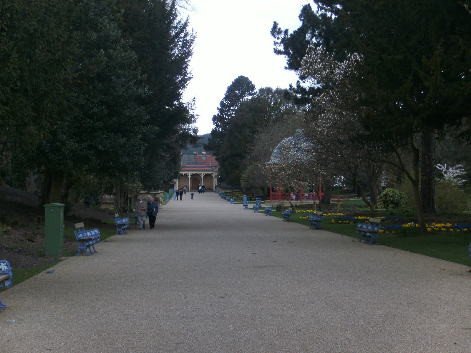
The mini bus was waiting outside Skipton railway station when I arrived. The weather could only be described as divine, making the journey a beautiful run to Buckden, going through the villages of Grassington, Kilnsey and Kettlewell. The Dales looked amazing in the sunshine, the spring had brought out the flowers and the surrounding moors and fells were greening up after the harsh winter.
 Arriving into Buckden, the bus pulled into the car park at the edge of the pathway sign posted for Buckden Pike. There were quite a few people already walking the path towards the fell in the early morning sunshine, and a few from the mini bus seemed to have the same idea as me too.
 Here a couple of Highland Cows grazing in the fields next to the pathway...
Beast...
Horse Head Moor on the left and Yockenthwaite Moor on the right here...
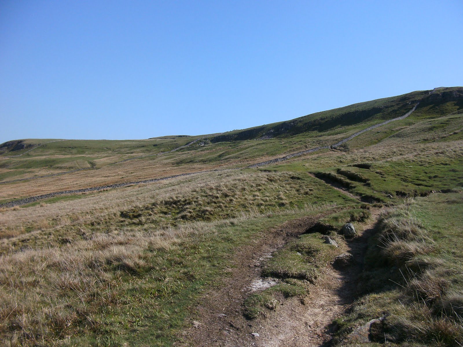
Approaching the steeper part of the fell side now...
Here hitting this much steeper part of the climb...
And eventually arriving at the summit Trig Point of Buckden Pike at 702 metres (2303ft)...
An interesting cairn and wooden spike keep the Trig Point company...
Looking west from the summit across Horse Head Moor towards a distant Pen-y-ghent and Whernside...
After taking in the Trig and surrounding area I made my way across the boggy summit plateau towards the memorial to the polish airmen who died in a plane crash here...
Great Whernside comes into view...
Walking next to the dry stone wall in the above picture was a tough old slog, due to the deep peat bogs that are strewn across this area. Walking between the two fells was not the best walking experience, just when you thought you were past the bogs, you was suddenly back ankle deep in another, this was very tiring indeed!
Some great views over to Little Whernside...
 I then followed the muddy path towards Great Whernside, but Little Whernside looked tempting to try and bag too...
The vast sprawl of Great Whernside from Cam Head... 
Taking a detour towards Little Whernside here...
Hunters Stone on the lane leading towards Little Whernside...
After walking down this lane for a good half hour, I was starting to worry about getting back in time to Kettlewell. And Little Whernside didn't appear to be getting any nearer either. After another 10 minutes or so a pathway cut up the side of the high bank at the side of the road, so I made my way up this, went across a sheep filled field, climbed over a dry stone wall, and came out onto a bleak moor of long tufted grass. Walking over this pathless, grim, gruelling and boggy moor, took me about an hour! It was the toughest bit of hiking done in a while, a truly horrible place to walk. After walking for that hour, falling and stumbling, trying to lift my legs above the tufts, my legs felt terrible. Upon reaching the dry stone wall at the top of the moor, it was a massive relief!
 On the other side of the wall is a path. Right takes you up onto Great Whernside, left for Little Whernside. Well after that terrible slog, I considered not bothering with Little Whernside as the time was after 3pm now! But I thought I've come this far, lets bag the thing. However, I have to say Little Whernside is the worst hill I've ever climbed, just one massive peat bog.

Little Whernside 'summit' at 604 metres...
 The peat bogs (and my rucksack)...
So now after taking a seemingly pointless detour, it was time for Great Whernside. Which from Little Whernside looked a serious hike again! So literally running over the wost peat bogs I've ever encountered, I made for the slopes of Great Whernside. I got this picture when I arrived at the top of this first gradient where it started to level out a little...
Looking back towards a now distant Buckden Pike...
The path now follows the ridge up towards the summit...
Approaching the rock strewn summit plateau...
Great Whernside summit Trig Point at 704 metres (2310ft)...
The pathway heads more or less due west from the Trig Point steeply downhill towards Kettlewell. Don't go across the ridge of Great Whernside as I did, as that path just suddenly stopped at a rocky outcrop! And another path I later found next to a barbed wire fence just went on and on and on. I wasted a lot of time up on top of the fell doing that, but I eventually made it down into Kettlewell village. All this messing about on the summit unfortunately meant that I missed my last bus by about twenty minutes, and ended up having to hitch a lift back to Skipton! Not ideal I realise, but the people who gave me a lift were a couple of interesting guys who both turned out to be avid dry stone wall builders from Keighley! So I'm very grateful for them for the lift, a pretty random hobby to have though right?
 Overall, apart from that setback at the end, and the to be fair awful Little Whernside, a great walk that I would strongly recommend. Although I'd wait for a good day to do it if I were you.
 Thanks for reading :)

Thursday 14 April 2011

Baildon Moor from Shipley 3.4.11


A there and back again walk, 6.5 miles 2-3 hours.

So the time came when my wife said to me,''any chance on you taking me on one of your hikes, I'm a little out of fitness at mo?'' Well, I had no choice and racked my tiny brains on where to take her. I'd taken her to Ilkley Moor quite a few times, so no point in that one. But it had to be a fairly good trek, but not a slog like Cross fell from Langwathby for instance!? I did a walk last October to the Skyrakes just outside Skipton, perfect I thought. She agreed, and so it was.
 It was Mothers day, and the trains were dodgy due to engineering works between Leeds and Shipley, so a bus to Shipley it was. The bus took one whole hour to get there, as the traffic was heavy and the time was now after 1pm, so we established it was far too late for Skipton, especially as the next train wasn't until another hour again!
 So what's to do in Shipley? Well looming over the town is Baildon Moor, it has a trig point, so this was now our objective. We now needed to walk to Saltaire via the canal, and past the impressive Salts Mill, proper Yorkshire...
Salts Mill... 
 
We then cut over the River Aire, and through Roberts Park...
We then found a footpath leading upwards. The pathway passed by a few interesting places where someone in the past has tried to cash in on Shipley Glen, whoever he was...
Heather leading the way...
Something spooky about this old Dodgems track...
At the top of the hill, we turned right along a bit more pathway which ran into a very nice housing estate on the edge of the Moorland...
At the end of the road above we turned right along the main road. We walked probably for about half a mile, before finding another footpath which heads upwards again past some houses...
This eventually came out onto another street, we were now high up above Saltaire. On the opposite side of the street was another footpath entrance, leading to Baildon Moor....
There are some good views from here back down into Saltaire, Shipley and over towards Airedale, and the Yorkshire Moors...
We then climbed up the field, towards a stile. Turned left down a farm road, through Hope Farm. Then we turned right and clambered up onto the Moor top...
A steep bit of the walk that leads you up onto the moor top...
Heather at the summit Trig Point, 282 metres...
Great views again from the summit. Here the buildings of Leeds...
Bradford...
A nice side view of Otley Chevin...
And towards Ilkley Moor...
After a good look around, a light discussion on Sink Holes, and getting blasted by the rather harsh wind - it was time to return to Shipley.
Signs of Spring...
Beasty guarding the Canal towpath...
And finally back into Shipley...
Overall a good little walk, even if we didn't intend to do this one! Thank you for reading.