
14.5 miles - 6 - 7 hours
I have always wanted to hike to High Cup Nick. Any picture I had seen of it, looked amazing. I first found it on the Visit Cumbria website, seemingly if you're from that area it's pretty famous. But to most the place is relatively unknown.
Most people seem to get to it by driving to Dufton and then following the Pennine Way path. But the nearest I could get to it was Appleby-in-Westmorland. It looked like a bit more of a trek, however looked good none the less, something reminiscent of the Cross Fell walk I did earlier this year. And with it being in the same area, I knew the time limit I would have with the trains.
Section 1 Appleby- in-Westmorland to Keisley

I arrived into Appleby at 11:15am, the weather was hot and sunny, and I could almost make out where I was heading to from the station platform. I headed off along the lane from the railway station, I turned right to go under the railway, and up onto the roadside. Crossing over another disused railway, I followed the road for a good 400 yards to where the road bends around to the right, but rather than following the road, from here take the path which splits off from it. This heads towards the incredibly busy A66 road. I thought at this point that there must be a bridge to cross it, surely? No, you need to take your life into your own hands, and prepare for a bit of running. On the central divide, there is a bit of a walkway to indicate that this is a legal crossing of sorts. But after a two and a half hour train ride, all this was a bit worrying. Opposite the central divide are some steps leading up the embankment of the road, with a public footpath sign to reassure you a little -with a stile at the top.
Here after crossing the A66, note the path in the central divide...

Once your up the embankment and over the stile at the top, you come out onto a country lane, directly opposite is another stile which takes you out onto a field...


The pasture leads out onto another lane. Turn right here, and walk about 100 yards along the lane, but watch out for a footpath splitting off to the left which cuts along the edge of a field. Then take the overgrown path for about half mile...


The overgrown path brings you onto this field, walk along the edge of this field for about another 100 yards...

From the field turn left at this stile, and cut over some boggy ground towards a farm house...

Beast guarding the way towards the farm house...

You can just make out the farm house here on the left, cut up the steep field ahead...

At the top of the field, the footpath becomes a bit more defined. You need to cut over the stile here...

Keep cutting over the fields following the footpath. You will eventually come to an area of rough ground with woods to its edge...


Turning left, look out for the footbridge in the centre of the unkempt field. The path at this point disappears entirely, the footbridge is the only evidence that it continues here at all. When crossed, continue over towards the trees...

A rough track cuts along the edge of the trees, turn left and follow this track along...

After this little bridge the track cuts right and allows you to head across a pasture, the track remains easy to follow...


At the edge of the pasture is another stile. This leads onto a well used lane via this gate, the lane runs past a large farm house on your right...


After about 300 yards the track has an option to go straight ahead or to turn left. Turn left here at this gate...

The track becomes a bit steeper here...

You eventually come to a cross roads, turn right here noting the public footpath sign for Keisley...


The path crosses over a small footbridge which leads out onto more fields...

Merton Pike sticks up above the fields...

Head towards the trees here...

Once at the trees, turn left, a small gated allows you to pass over this dry stone wall, you then pass over a footbridge which sits over a fast flowing beck...


Follow the path around to the right after the bridge. A dry stone wall cuts across the field here, keep this on your right for a good 100 yards...

Eventually you will come to a signpost. You need to cut right here, and climb over the wall via the stile, then follow the path east across the field towards a farm house. A farm track runs up the side of the house towards Keisley...


The farm track brings you out onto a lane, turn right here. You can just make out the next sign post in the below picture, where you need to cut left onto a lane...

It's not very clear on my picture, but the sign points to 'High Cup Nick via Bow Hall'...

Section 2: Keisley to High Cup Nick

Turning left to where the sign points, you cut up this lane...

Just before you reach the farm house at the end of this lane, turn left through this gate...

The gate leads out onto a pasture, walk towards the below farm house. The barn at this farm house was under renovation, and so the footpath had been changed in order to by pass the barn and farm yard safely..


Here by-passing the farm, with pyramid shaped Dufton Pike up ahead...

The temperature at this point was intense, and I was missing a hat!
The below picture doesn't really do this view justice, it was quite possible to make a umber of Lakeland fells...

There is good mile and a half of hiking across these long grassy fields, keeping the above dry stone wall on your left. The footpath will eventually take you out onto the Pennine Way which cuts up from Dufton. There was a number of cars parked up here, which if you are driver you can access High Cup Nick easily from here in a short walk.

Turning right here, and this is where things get quite steep, the well trodden Pennine Way track basically takes all the way up to High Cup Nick. After walking the track for a good half mile, you come to a fork in the road, keep left here...

Eventually you come to this gate, initially I thought you needed to pass through it and continue along the farm track. Not so, you need to go left here, and go through the kissing gate which you can just make out on the left of the below picture...

The path becomes much more rugged here, and a lot tougher going. Cairns mark the edges of the path...

This leads you onto the northern edges of High Cup Nick...

Murton pike stands behind Middle Tongue, at the northern side of the High Cup Gill...

Following the southern ridge of High Cup Nick...

Looking down on Nichol's Chair...

And scrambling down the side of High Cup Gill for a closer look...


From here you get some more dramatic views of High Cup Gill, here the Whin Sill rocks up close...

I then made my way to the head of High Cup Nick...


It was time for a sit down at this point, just to take in the shear awesome spectacle of High Cup Nick. I then had a bit of an explore around the vicinity. I noticed Meldon Hill sticking up directly behind the Gill, and thought that looks worth getting to the top of. There is a trig point on it's summit, and at 767 metres was very tempting. But after walking for a good 15 minutes towards it, I decided not to chance it, and end up missing my train. Plus it looked like one massive peat bog!
Meldon Hill...

So I hiked back towards High Cup Nick...

Section 3: High Cup Nick to Harbour Flatt

From here I cut left following the marker posts along the southern edge of High Cup Gill...


The path becomes a bit faint in places, but you get some great views - now high up above High Cup Nick...

The path cuts over some very boggy ground in places. Then I noticed these two cairns far off, on the hill top...

These looked to good to miss...

These cairns seemingly mark the highest point on Murton Fell. From here you get fantastic views towards Great Dun Fell - with its tell tale golf ball radar station on its summit, and of course the magnificent Cross Fell behind...

I then cut back across the deep peat bogs towards the path along the side of High Cup Gill, following the path now down hill towards Merton Pike...

A distinct track becomes visible from here. Following this track down hill along the flanks of Middle Tongue, a Kestrel decided to let me know I was on his or her turf, by flying low over my head repeatedly...

Kestrel...

Looking back towards High Cup Nick...

The track leads you onto a farm called Harbour Flatt.
Section 4: Harbour Flatt to Appleby

Cut across the pasture which lies at the side of the farm, you will eventually come to a stile. This brings you onto lane. Turn left, and walk back towards the farm via the lane...

Opposite the farm is a track which is signed for Brackenthwaite. Open the gate and follow the track west...

The track continues for a good half mile, it then cuts across some unkempt fields, then your back into the woods...

Looking back, Great Dun Fell far right, Cross Fell far left, and Dufton Fell and Middle Tongue centre...

You will come to a lane after the woodland. Follow the lane for about two miles, you will eventually come to a T-Junction. Turn right here towards Appleby. This time thankfully, you pass under the A66!!!...

Just after you pass under the A66, take your first right. Follow this for about half a mile, and this will take you back to the railway station...

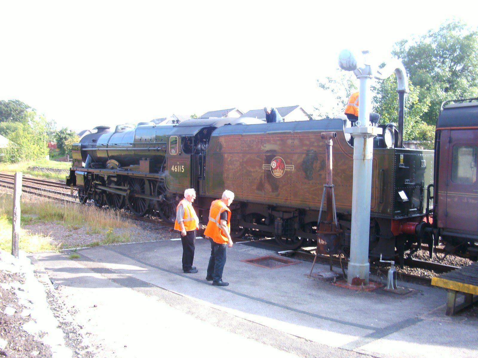
Now unfortunately this wasn't my train back to Leeds, but it was nice to see it...
Overall, a fantastic walk, thanks for reading :)
